The Contour Map Mode: The Terrain That Does Not Hide What Is Behind It
Contour Map skips the occluding pass every other ridge mode in its engine performs. Dropping the hidden-line step is exactly what turns a landscape into a plate you read from above.
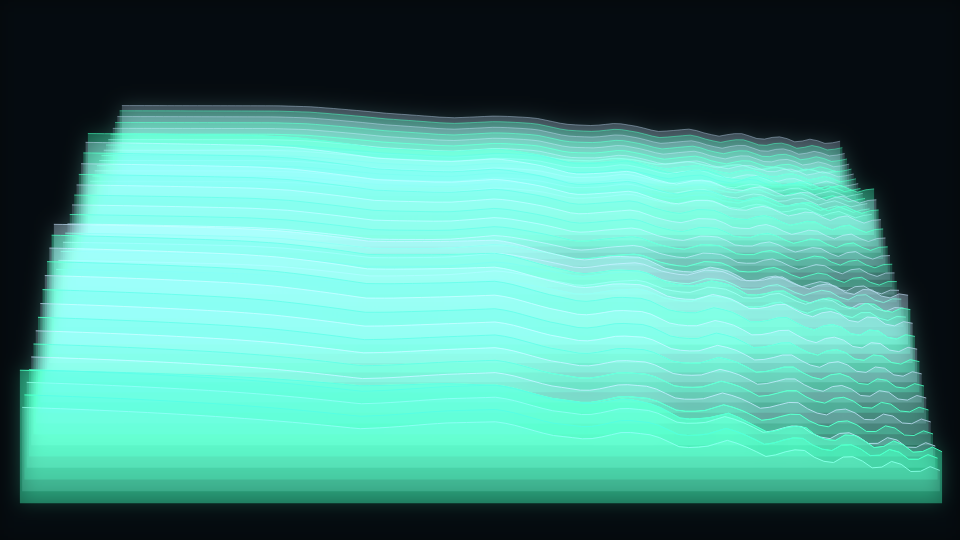
The Terrain engine is the one place in the catalogue where the last few seconds of the mix ARE the geometry. Contour Map is its flattest reading of that: filled elevation bands read as a topographic plate.
What the other modes do and this one does not
The engine's ridge modes perform a hidden-line pass. Before a row's outline is stroked, a closed copy of it is painted in the opaque background colour, so a nearer row completely hides the row behind it. That painter's-algorithm fill is what makes a stack of curves read as a landscape rather than as cross-hatching.
This mode deliberately does not. Its band is drawn translucently instead, at an alpha that rises with how near the row is and with the beat the row was born on, so rows accumulate through each other. Nothing is hidden and everything is slightly visible through everything else, which is precisely the reading a topographic plate wants: you are looking down at the whole field, not across it at a horizon.
The contour itself is stroked as an OPEN path afterwards, at half the configured Thickness. Stroking the closed shape instead would draw the two vertical drops back to the baseline as though they were part of the terrain, which reads as a box around every row.
Where the rows come from
Every frame pushes the current spectrum into a history buffer, and the drawn rows ARE that buffer, nearest last. History ships at 48 here and bounds how many rows the buffer keeps. Speed is rows-per-frame, normalised so the catalogue default is exactly one row per frame and capped at four pushes, because each push repeats the CURRENT spectrum and a large burst would write several identical rows and flatten the relief into plateaus.
Each new row also records the beat envelope at the moment it was born, and carries that lift backwards through the field for the rest of its life. So a kick becomes a band you can still pick out several seconds later. A heightfield built purely from band levels drifts with the mix and reads as weather; this is what makes it read as rhythm.
Relief, roughness and the shape of a band
Relief scales the whole height and ships at 0.45. Roughness ships at 0.2 and blends between the band's raw level and its square: at zero the profile is linear in level, and turning it up exaggerates peaks relative to the body of the signal. Low values keep a map legible, which is why this mode ships it low.
Perspective does two jobs at once. It sets the exponent of the perspective easing that bunches rows toward the horizon, and it sets the horizontal inset that narrows each row as it recedes, so parallel rows converge like a plane. One control, two effects, both pointing the same way.
Containment on an offset, not a radius
A row's height is an offset from that row's own baseline, so the limit is the distance from the baseline up to the top of the frame box rather than a radius from the centre. Passing a vertical offset through a radial limit is exactly how geometry ends up leaving the frame at the top while measuring as contained, and this engine is where that lesson was learned.
When to reach for it
Ambient, post-rock, film score, documentary beds, data and science content, and anything that suits a cartographic look. It is calm without being empty, and it holds text well because its density is even across the frame. For the mirrored travel corridor built from the same field, read The Canyon Scroll Mode; for the softest mode in the engine, The Dune Field Mode: The Only Terrain That Never Strokes a Line.
Open Contour Map in the gallery or go to the editor.
Reviewed by the editorial team. Report a correction.
Keep reading
Was this page helpful?
Anonymous. Only this page’s address and your yes/no are recorded, and only if you allowed analytics cookies.
Ready to make your own?
Open the editor, drop in a track, and export a watermark-free video: free, no account.
Open the Editor